

Red House Maps
Historic Maps
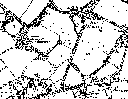
Red House Park 1890
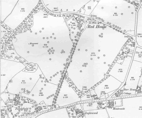
Red House Park 1901
Red House Park 1960's
Note there is only one pool as the top pool was only created to assist in drainage after the motorway was built during 1968-1970.
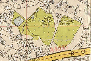
Red House Park Now

Image produced from the Ordnance Survey Get-a-map service.
Image reproduced with kind permission of Ordnance
Survey and Ordnance
Survey of Northern Ireland
Quick Links
- Click here to
- Please send me photographs and historical information on Red House Park
- This site supports the work of the Friends of Red House Park and is a micro-site within www.B43.co.uk - Great Barr Past and Present